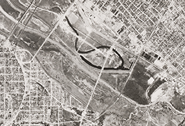
Close up of Grid 11 showing the Corinth Street Viaduct, 1945
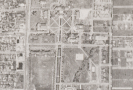
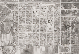
Grid 07 close up showing SMU campus, 1945
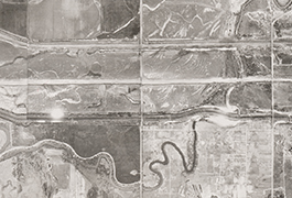
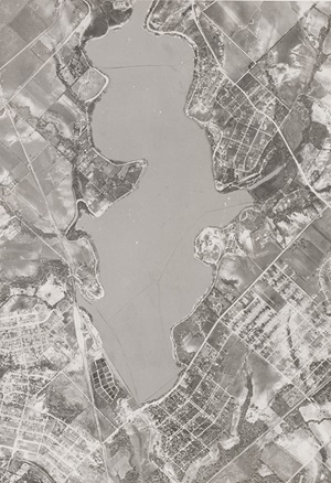
Grid 06 close up showing Trinity River, south of Dallas Love Field, 1945
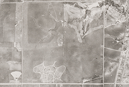
Grid 03 closeup showing Hillcrest Cemetery and Northwest Highway, 1945
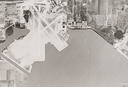
Grid 09 closeup showing Hensley Field, Dallas Naval Air Station, 1945
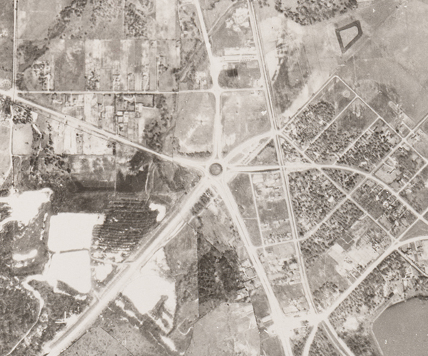
Grid 05 closeup showing Town of Irving, 1945
Overview
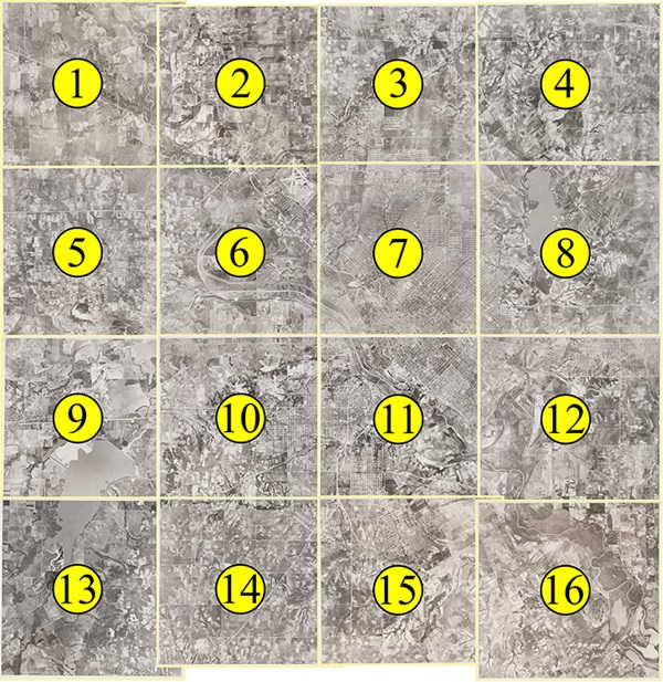
There are 16 pairs of images in the Dallas Aerial Photographs, 1945 USDA Survey digital collection that portray various locations in the Dallas metropolitan area as well as Irving, Grand Prairie, and Hutchins. The original photographs were taken by the Army Air Forces for the United States Department of Agriculture and were developed by the Western Aerial Photographic Laboratory in Salt Lake City, Utah. The purpose of the photographs was to survey farmland, which covered large portions of the Dallas area at the time.
The aerial survey collection is part of the Foscue Map Collection. The library worked with regional historian George Cearley to identify important features in the photographs such as major roads, railways, and landmarks. A transparent overlay with location markers was created for each photograph to label these features. In the digital collection, there are two versions of each image, labeled and unlabeled. Labeled images replicate the physical overlays created for the originals and correspond to a legend that appears below the image.
Aerial Survey Grid
To view an individual high resolution image, click on the area of the map you wish to examine. When you do so, you will be taken to the web page for that image that contains a high quality aerial photograph with yellow markers and a corresponding legend of places. Place names are displayed in the key below the image. To zoom in and move around, use the tool bar across the top of the image. The small image to the left will tell you what part of the photograph you are viewing by displaying a shaded red area around the portion of the image you are viewing.
Each image also contains a link to the unlabeled version of the same photograph.
 About the Collection
About USDA Aerial Surveys
The United States Department of Agriculture’s Farm Security Agency created aerial photographs as a means of surveying farmland. The practice of surveying began shortly after the 1933 Agricultural Adjustment Act introduced programs that would
 require farmers to provide accurate measurements in order to participate. Farm programs were designed to stabilize prices, arbitrate mortgage agreements, and insure loans for rural housing and business. Originally, surveying was done by placing chains around fields and creating hand drawn maps. By the 1940s, aerial photography was used as a more efficient and accurate method, and the USDA created two aerial photography labs, one in Asheville, North Carolina, and the other in Salt Lake City, Utah (which developed this set of images). USDA aerial photography was consolidated to the Aerial Photography Field Office (APFO) in Salt Lake City in 1976.
These photographs were created as a map-controlled mosaic. The survey is constructed by assembling multiple photographs using topographic maps for orientation. Typically, only the center of each photograph is used for the mosaic since it represents less displacement.
View more aerial photographs of Dallas in these collections from the Foscue Map Collection:
Copyright usage terms vary throughout the collection. Each item contains information about usage terms. If SMU does not have the right to publish the item on the Internet, only the item's metadata will be available and the digitized object will be available on a restricted access basis. Such items may only be viewed on campus. When items are available for use, please cite the Foscue Map Collection, SMU Libraries. A high-quality version of these files may be obtained for a fee by contacting degolyer@smu.edu.